Monitoring Water Bodies and Wetlands in the Sahel using Continental Scale Remote Sensing
water bodies across the Sahel region
water bodies with a highly significant negative lake level trend
water bodies with a highly significant positive lake level trend
resolution maps of erosion and deposition patterns
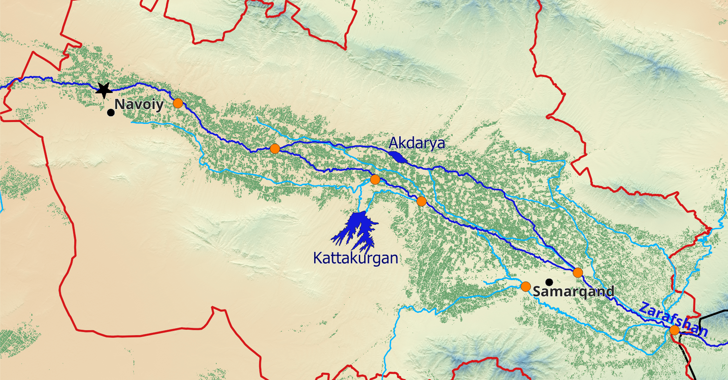
Within the SAWEL Project, hydrosolutions GmbH has developed the Sahel-Water web Application. It brings together innovative remote sensing techniques for monitoring lakes and river stretches all over the Sahel region. This web application implemented in Google Earth Engine offers access to a database of more than 300 water bodies in 10 Sahelian countries. Based on Landsat and Sentinel-2 optical imagery we can now quantify the sediment balance of these water bodies. This information is as well derived from shoreline observations and altimetric data. Since the nearshore bathymetry of the present is known, changes in the waterline curvature over time tell us where and at which rate sediments have been deposited or eroded.

The methodology behind the app can be applied to water bodies with strong seasonal fluctuations in water levels. The Sahel Region with its distinct wet and dry seasons and the cloud-free conditions represents an ideal case study for the newly developed technology. In combination with precipitation and evaporation data (provided through global re-analysis products or local weather stations), the app provides all necessary inputs for calculating the water balance of the monitored water bodies. Consequently, within the SAWEL Project, we have shown for Lac Wegnia in Mali that the drivers of negative lake level trends can be identified. The Sahel-Water app is therefore a powerful tool for promoting the sustainable use of the scarce water resources in the region and for planning targeted interventions.