In the Sahelian region, water resources and aquatic ecosystems are increasingly stressed because of rising human appropriation and climate vagaries. Using state-of-the-art remote sensing and machine learning, we investigate the dynamics of surface water bodies at continental scales, from Western to Eastern Africa. A special focus is on the Ramsar sites Lac Wegnia and Sourou basin in Mali and Burkino Faso as well as the Ethiopian Rift Lakes region.
number of seasonal water bodies in the Sahel
coverage of total area by wetlands, inland deltas, rivers, lakes.
typical length of dry season in the Sahel
time to double population numbers in the Sahel
Sahelian Wetlands
Water insecurity in the Sahel is chronic and negatively affecting food security and nutrition. In response to this, much focus has been put on increasing production and productivity in the dryland areas of the region, either through industrial scale irrigation schemes or by helping farmers to achieve more ‘crop per drop’. This is undoubtedly a key component of resolving food security, but not the only one. Wetlands are disproportionately important but are frequently overlooked. These aquatic ecosystems, comprising the rivers, floodplains, inland deltas and lakes, cover more than 10% of the region and are essential for farmers, fisher communities and pastoralists, especially in times of water insecurity. Because of growing appropriation for human use, increasing levels of water pollution and pronounced climate variability in the entire region, water resources and aquatic ecosystems are increasingly stressed and sound water management strategies become ever more important. hydrosolutions GmbH is developing and using state-of-the-art remote sensing analysis to quantify hydrological changes in these poorly gauged hydrological systems to develop sound and sustainable management and development strategies.
.jpeg)
Lac Wegnia
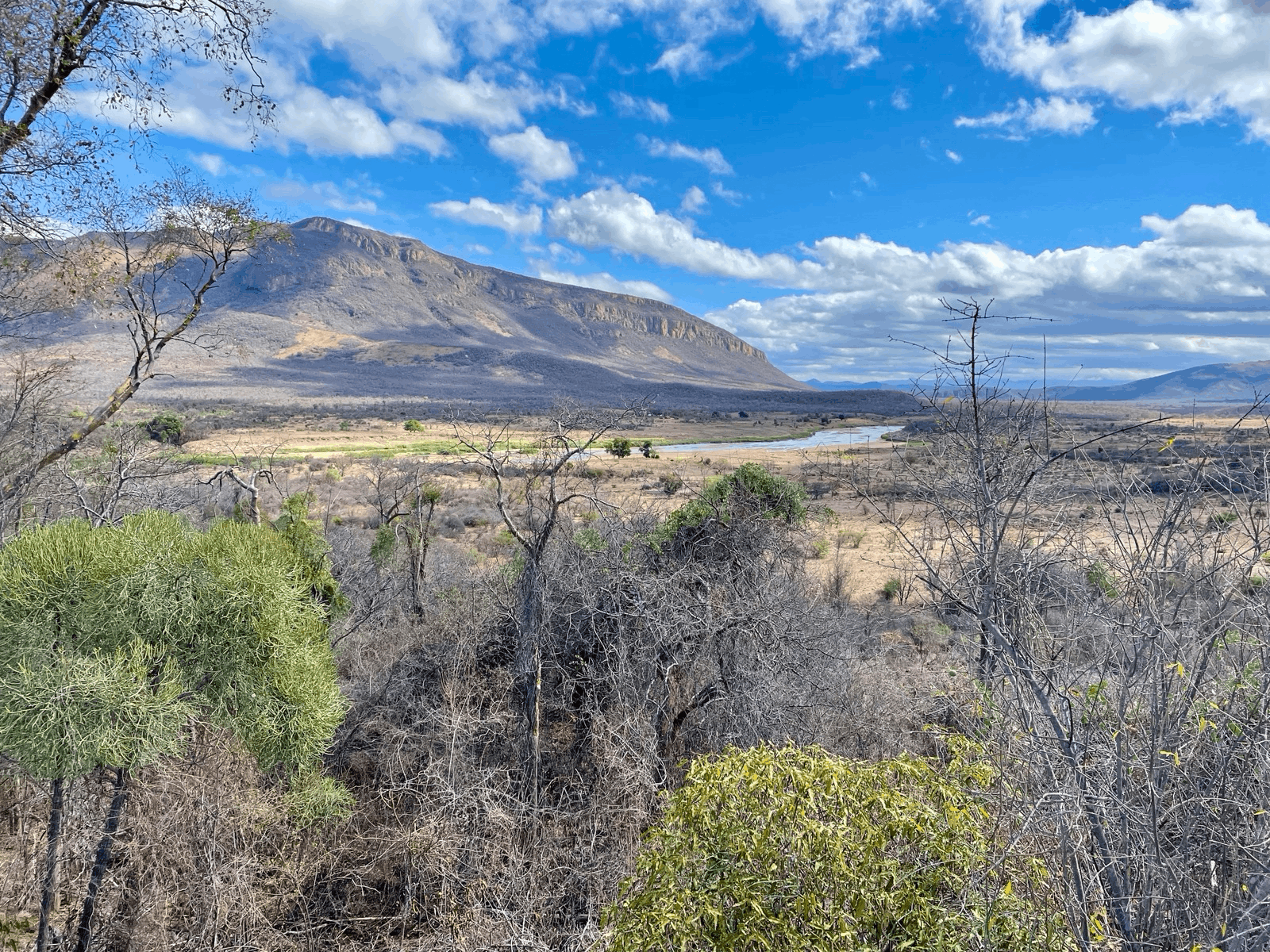
The Lac Wegnia Ramsar site is located 100 km north of Bamako in a topographic depression that fills with water from seasonal rains on an annual basis. There is anecdotal evidence that the lake levels have been declining over the last 2 decades. Since the lake and its tributaries are entirely ungauged, hydrological analysis needs to rely on remote sensing for water balance assessments.

Remote sensing observations over the last 20 years confirms a declining flood frequency at the locations of the tributaries, in the western and eastern parts of the basin. The key question to be answered is whether this is due to increasing levels of sedimentation, declining water levels in general (e.g. due to decreasing inflows or increasing evaporation levels over the lake surface) or a compound effect.
Using Google Earth Engine, hydrosolutions GmbH has developed and implemented a water surface mapping procedure that allows for the quantification of storage changes in the lake through the use of the high-resolutions DEM. Key findings are that climate-driven increases in temperatures have translated into increasing levels of evapotranspiration. Measured as height of water, atmospheric water demand is almost 4 times as large as lake inflows and precipitation combined. In cases of extended dry seasons, this leads to a complete drying of Lac Wegnia
.jpg)
The method developed for Lac Wegnia translates easily to the entire Sahelian region and thus allows for continental-scale observations.
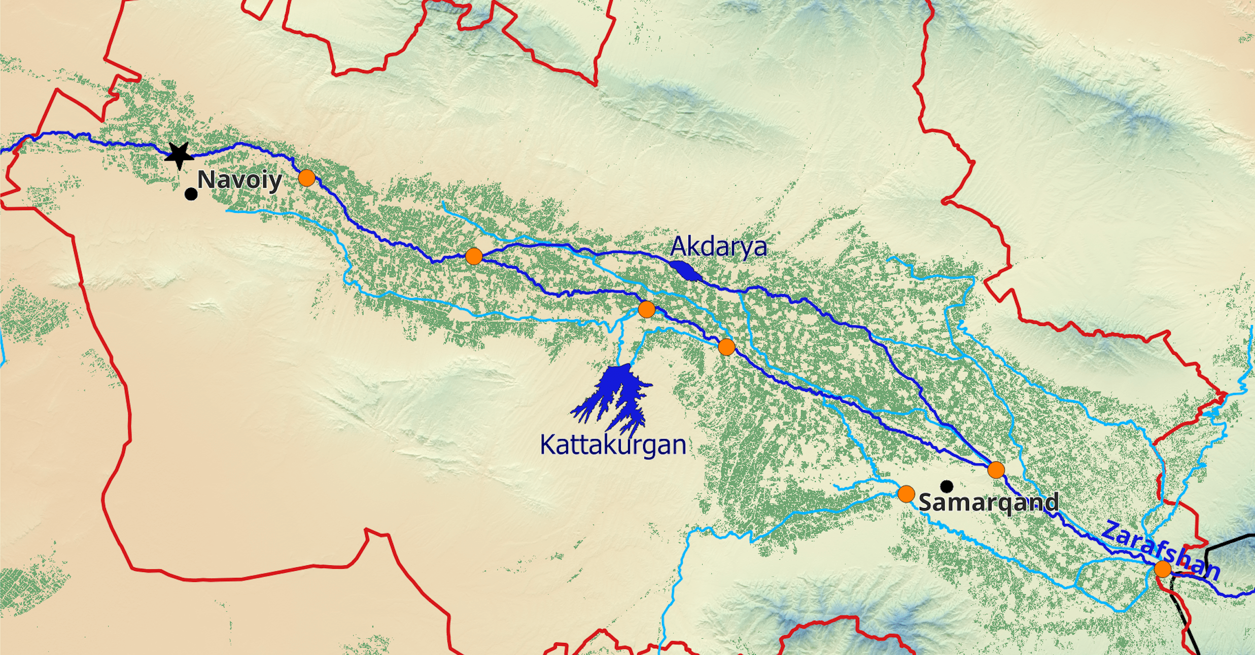
Sourou Transboundary Basin
The transboundary Sourou Basin is shared between upstream Mali and downstream Burkina Faso. It is part of the larger Volta catchment. The region, like the other Sahelian countries, suffers greatly from recurring drought. Human pressure is exponentially growing in line with population numbers. Agro-pastoralists encroach more and more on the ecosystem thus excerpting an increasing pressure on the wetland. With increasing use of fertilizers and herbicides and pesticides and other agro-chemicals, water quality is deteriorating and threatening a local biodiversity. A lack of coordinated transboundary water resources management between the riparian stakeholders regularly leads to adverse impacts on upstream agriculture due to the damming of the river in the downstream.
.jpg)
To help improve transboundary water management, hydrosolutions GmbH has developed a monthly agro-hydro-climatological bulletin summarizing key statistics of the region for local stakeholders. Since the basin is entirely ungauged, we use remote sending data and climate reanalysis information to characterize the system.

Ziway-Shala Lake System
The Ziway-Shala sub-basin is situated in the Ethiopian Central Rift Valley and covers an area of approximately 15'000 sq km. It is a closed endorheic sub-basin, containing the four major lakes Ziway, Langano, Abijata and Shala. Lake Ziway is the only fresh-water lake in the basin, mainly fed by the Katar and Meki rivers, which drain the highlands on the East and West of the Central Rift Valley respectively. Lake Langano has several tributaries and one major outflow to Lake Abijata called Horakelo River. Lake Abijata is a terminal lake, has a small catchment itself and depends on inflows from Lake Ziway (Bulbu-la River) and Lake Langano (Horakelo River). Lake Shala is situated in a topographically separated sub-basin and has no surface water connections with the other lakes in the system.

The Ziway-Shala sub-basin plays a key role in the Ethiopian food supply system and its growing population is heavily dependent on agricultural income. As precipitation in the basin shows a decreasing trend, farmers increasingly exploit the scarce freshwater resources to irrigate their fields. Numerous smallholder- as well as few commercial farmers abstract irrigation water from Lake Ziway, its tributary rivers Meki- and Katar- as well as from Bulbu-la river. There is no monitoring system or regulation of irrigation water abstraction in place and concerns are that irrigation water use exceeds a sustainable rate. A recent study has shown that Lake Ziway lost 12.75% of its storage between 2009 and 2018. The storage of the terminal Lake Abijata is decreasing at an even more alarming rate, indicating that the hydrological system is out of equilibrium.
By using remote sensing and reanalysis data, hydrosolutions GmbH is helping to improve the understanding of the water balance in the sub-basin. Like this, evapotranspiration fluxes, lake storage changes and water use for human appropriation can be quantified. This study helps to design proper interventions to preserve the holistic function of the hydrological system