The construction of the Qosh Tepa Canal in Afghanistan, designed to divert a significant portion of the Amu Darya River's water for irrigation, threatens to disrupt existing water-sharing agreements among Central Asian nations, potentially causing regional economic impacts, geopolitical instability, and straining diplomatic relations, necessitating a recalibration of water-sharing agreements and the introduction of adaptive frameworks that account for all riparian nations.
Current mean water supply in the Amu Darya River (billion cubic meters)
Afghan contribution to total Amu Darya discharge
Design capacity of Qosh Tepa Canal (billion cubic meters)
Planned irrigated area in Afghanistan (hectares)
Tipping the Scales: The Future of the Amu Darya River Amidst Agricultural Ambitions
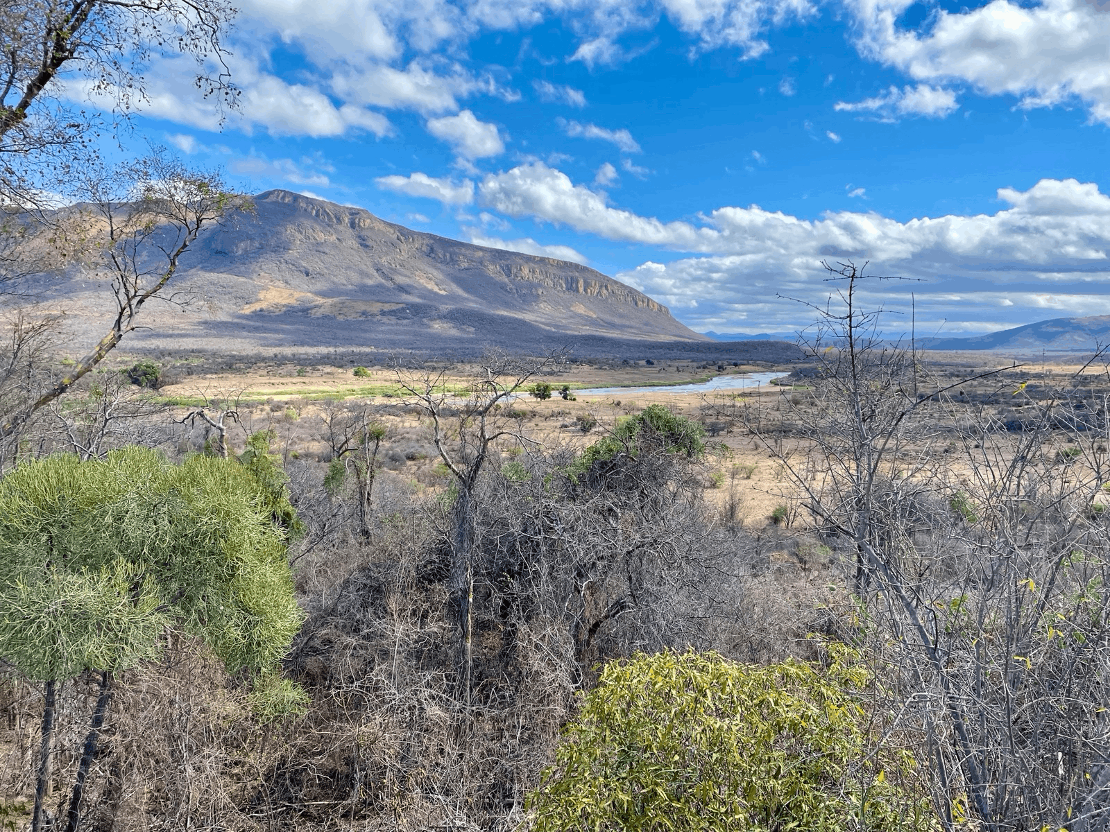
In the heart of Central Asia, tensions are rising around one of the region's most vital lifelines - the Amu Darya River (Figure 1). The historic waterway has nourished civilizations for millennia, fostering cultural exchange, economic growth, and geopolitical interplay. Today, however, it stands at the center of a potential crisis that could send shockwaves through the region's delicate geopolitical balance.

In the northern reaches of Afghanistan, construction is underway on the Qosh Tepa Canal (Figure 2), an ambitious infrastructure project designed to divert a significant portion of the Amu Darya's water for irrigation. With a design capacity of 20.5 billion cubic meters (bcm) per year and an ambitious goal to irrigate 550,000 to 600,000 hectares (ha) of land within five years, the canal represents a watershed moment in Afghanistan's development.

Yet, this project threatens to upend decades-long water-sharing agreements between the riparian nations that rely on the Amu Darya River. Currently, all nations except Afghanistan participate in the interstate management of the Amu Darya River Basin's water resources. Following the Soviet Union's collapse, the remaining four countries in 1992 agreed to adhere to existing water allocation structures and principles, as outlined in Protocol 566 and the "Master Plan" approved in 1987.
The Interstate Commission for Water Coordination (ICWC) in Central Asia, also established in 1992, is responsible for determining regional water policy and approving water withdrawal limits. The Basin Water Organization "Amu Darya" (BWO Amu Darya) manages the allocation of water.
The current water allocation is set considering a total river water withdrawal of 61.5 bcm, minus Afghanistan's (AFG) diversion of water (2.1 bcm), with the following ratio: Kyrgyzstan (KGZ) 0.6 %, Tajikistan (TJK) 15.4 %, Uzbekistan (UZB) 48.2 %, and Turkmenistan (TKM) 35.8 %. Water allocation has been mostly conflict-free, with planned and actual values of water delivery aligning well during non-growing seasons, but less so during growing seasons. Water management has become problematic more recently during the prolonged drought under which the annually renewable water supply has fallen to 50.7 bcm, disadvantaging the downstream states Uzbekistan and Turkmenistan, which already struggle with water scarcity due to intensive irrigation practices and decaying irrigation infrastructure.
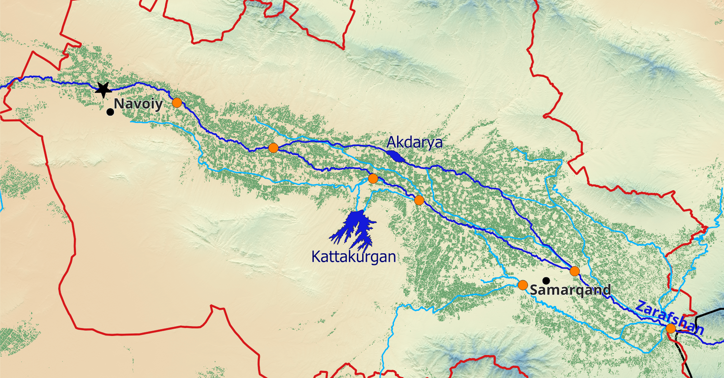
Figure 3 shows the current water balance with water supplies from the upstream and to the downstream highlight in bright blue colors and average water allocation values to the large oases highlighted in green. The available water is currently almost equally distributed between up-/midstream (52 %) and the downstream (48 %, see Figure 1 for the domain demarcations).

To understand the impact of the Qosh Tepa Canal on the Amu Darya water balance, let's come up with a development scenario and look at the numbers. Clearly, such a scenario is at this stage entirely hypothetical but can serve as an indicator of a possible future development. Currently, Afghanistan's contribution to the Amu Darya’s runoff is approximately 14.9 bcm per year under normal hydrological circumstances (Figure 1).
If we assume, for the sake of it, a similar dominant cropping pattern as in the Taloqan River basin (large right-tributary to Kunduz) further to the East, we can estimate water demand for a simple winter wheat - rice rotation system in the scheme under development. So, let's make some crude assumptions to estimate consumptive water demand. First, we assume a conveyance efficiency of 70% and field-level application efficiency of 60%, i.e. typical values for irrigation schemes in the given context. For crop water requirements then, we take into account local climatic and soil conditions using the FAO Climate Information Tool, and set the gross irrigated area to 800’000 ha (400'000 ha for winter wheat and the same for rice). Under such hypothetical scenario, the canal could potentially utilize almost the entire runoff generated within Afghanistan’s territory, or 30% of the total current mean water supply in the river (Figure 4).

A development such the one described under the above scenario would thus tip the scales and the water balance between up-/midstream and downstream becomes heavily skewed towards the former (83 % versus 17%). Such a scenario spells disaster for parts of the downstream nations. The high irrigation demands of the Uzbek and Turkmen economies makes them highly vulnerable to upstream water diversion. The Qosh Tepa Canal could exacerbate the water scarcity especially in Karakalpakastan and Khorezm province in UZB and Dashoguz Province in TKM and threatening agricultural sectors and livelihoods there.
The potential consequences extend beyond regional economic impacts. By fundamentally altering the water balance in the Amu Darya River Basin, the Qosh Tepa Canal could stir geopolitical instability and strain the delicate diplomatic fabric of Central Asia. The absence of Afghanistan in the existing water-sharing agreements is a key complication, leaving a critical gap in regional water governance.
As the Qosh Tepa Canal construction continues, Central Asian nations must recalibrate their water-sharing agreements and build flexible, adaptive frameworks that account for all riparian nations. Maintaining the river’s health and ensuring equitable and effective water distribution is fundamental for the region's stability, prosperity, and peace. In the face of this imminent water crisis, collaboration and negotiation should prevail over competition, especially also considering the added challenges from future climate change and growing populations. The Qosh Tepa Canal could be a catalyst for change, ushering in a new era of water diplomacy in Central Asia.
International negotiations can be supported by state-of-the-art hydrological modeling, tradeoff analysis and monitoring, including from space-based remote sensing. Local stakeholders can be guided by these novel technologies that can help support objective, facts-based decision-making. The international community can support the process so that the region's nations can rise to the challenge.