The project aimed at improving water management in an arid region where agriculture is only feasible with full irrigation. The Heihe mid-reach basin in Gansu Province was chosen as a pilot area to demonstrate how to set up a real-time monitoring, modelling and control system for water management. The management system addressed two spatial levels: The level of the mid-reach basin and the level of one irrigation district. On the basin level a real-time system for managing conjunctive use of surface water and groundwater was proposed. While in the chosen irrigation district, Luotuocheng, the micro-management of groundwater use using smart card metering was implemented a region where individual pumping wells have a capacity large enough to make the installation of monitoring.
Background
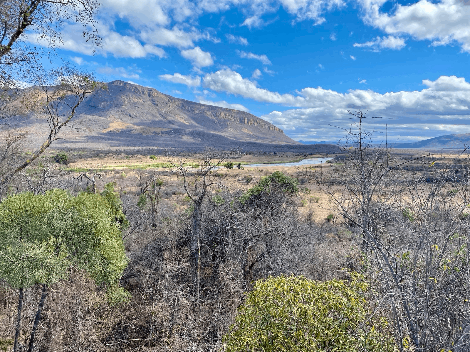
The Heihe river basin is the second largest inland river basin in China. The river water is the main water source for a highly productive agriculture in the mid-reach basin. Its demand was so high by the year 1997 that almost no water remained in the river, denying the downstream basin the basic ecological water needs. Therefore the state council decided that from 2000 on, half of the incoming river flow had to be handed onto the lower reach basin. This put pressure on farmers who turned to groundwater pumping in the erroneous assumption that it would lead to increased river flow.

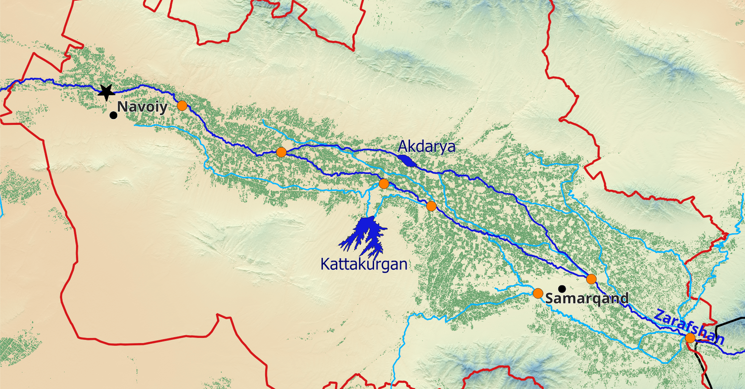
Luotuocheng irrigation district is located at the end of the western main irrigation channel. It therefore suffered from limited surface water supply from the beginning. From the 1990s on, farmers increasingly exploited the aquifer to provide water for the growing agricultural area. As a consequence, the district has developed one of the two major groundwater depression cones in Heihe mid-reach basin. The groundwater table has been declining continuously by about 0.66 m/year since 1990 and depth to groundwater is now as large as 70 m.
Management System Design
Groundwater is recharged at the margin of the basin and by seepage along the upper parts of the two rivers, the Heihe and the Liyuanhe. The recharged groundwater discharges directly or indirectly - via springs and rivulets - to the lower part of the Heihe. As every drop of groundwater used consumptively on the way between recharge and discharge will not drain to the river, groundwater use also influences the river flow. This means that the mid-reach basin has to control the total irrigation water use, which is the sum of surface water diversions from the river and abstraction from the aquifer.
On the level of the mid-reach basin, the project team designed a real-time monitoring, modelling and control system to provide decision support to water managers in the Heihe pilot region for optimally allocating groundwater and surface water to foster conjunctive use of water resources in order to fulfill the state council’s regulation.
On the level of Luotuocheng district, the emphasis was on policy and overpumping control. Novel technology has been implemented. Since May 2015 all 680 pumping wells in the irrigation district have been equipped with smart meters, operated by swipe card, to meter and control groundwater pumping. A volumetric water fee has been introduced and collected via the charging of the swipe card.

The real-time pumping data in Luotuocheng, together with water use data of the other districts and further monitoring data such as groundwater levels and river flows are sent to the data platform, where they are assimilated by a real-time groundwater model providing at any time the state of the aquifer and initial conditions for a planning tool which allows to assess the effectiveness of user-defined irrigation scenarios for the whole of the mid-reach basin.
Real-Time Monitoring
Groundwater Level Monitoring
Data from 138 observation wells are available in Heihe mid-reach, with 101 wells monitored in real time. The transmission of monthly averaged data to our data platform has been operative since May 2016.
Groundwater Pumping Monitoring
The wells of Luotuocheng irrigation district have been monitored by smart water meters since May of 2015. The data (abstracted volumes per well) were transferred to the data server on a monthly basis. For the other districts the official data published in the annual water resources reports were collected.
Remote Sensing for Irrigation Mapping
To map irrigation areas, we use surface reflectance of three spectral bands (red, near-infrared and middle infrared) provided by different remote sensing platforms including MODIS Aqua and Terra, Landsat 7, Landsat 8 and Sentinel 2. Annual irrigation maps at 30 meters resolution have been produced for the study period 2000-2017. The results show that the total irrigation area in Heihe mid-reach has increased by 20 % from 2000 to 2017 regardless of ecological release of river water to the downstream basin since 2000.
Surface Water Import Monitoring
For the basin scale modelling, the official data of gauge stations on the Heihe and the Liyuanhe were collected. On the level of the Luotuocheng irrigation district, net surface water use in the district was monitored through two flow gauging stations before and after the diversions from the West Main Canal to Luotuocheng district. Three methods were used in parallel to guarantee a complete time series of inflow to and outflow from Luotuocheng irrigation district year round:
- Fixed station DischargeKeeper by photrack AG
- DischargeApp mobile phone-based monitoring of flow and discharge
- Photographic images of staff gauge sticks
The first two methods supply a flow rate,the latter a water depth which has to be converted into a flow rate by the Manning equation.
Modeling and Decision Support
Real-time Groundwater Model of Heihe Mid-Reach
A distributed water balance model for Heihe mid-reach has been set up. The model is a horizontally 2D one-layer unconfined groundwater model implemented in MODFLOW. The 1 km ×1 km discretization is sufficient to represent the reaction of the aquifer to changes in irrigation strategy and river flows in the Heihe mid-reach. It reproduces the past head observations as well as surface water outflows to the downstream very well. On the basis of this distributed model, a real-time groundwater model has been developed which assimilates new observation data in monthly steps. An ensemble method was used to represent uncertainty information. The results of the real-time model provide initial conditions for the planning tool which assesses the longer-term development of groundwater levels for user-chose scenarios.

Online Tool of Groundwater Modeling and Allocation
An online groundwater simulation tool has been designed for the mid-basin water authorities to provide interactive decision support for water allocation. The users can run irrigation scenarios, modify crop choice, area and irrigation type and visualize the projected change in groundwater level as consequence of their actions. The model is embedded in an interactive web-interface and accessible to the user through the internet with all standard web browsers.

Modeling and Forecasting of Heihe River Discharge
An online Heihe runoff forecast model has been developed and implemented based on a statistical machine learning approach. In operational use, the tool gives monthly runoff forecasts of Qilian, Zhamashike and Yingluoxia gauging stations on the basis of decadal flow, precipitation and temperature data. However due to data restriction the current model data input is only until December 2015. For the 3 month prediction of flow, the method is superior to a prediction based on the expected value of a decadal flow as derived from long-term means.
Policy Implementation
Water Right, Water Fee and Water Allocation Quota
As one of 80 pilot counties to test the agricultural water pricing reform, Gaotai County, where Luotuocheng irrigation district is located, started the reform in 2015. The five objectives of this agricultural water pricing reform are:
- Control over the total amount of water used
- Quota management
- Terminal metering
- Adjustments of water price
- Introduction of block structure of water prices
The new water pricing regulation came into effect in Luotuocheng irrigation district in April 2015. Before the water pricing reform, only a basic water fee (0.0025 CNY per cubic meter for surface water and 0.0049 CNY per cubic meter for groundwater) and a water resource fee (0.005 CNY per cubic meter for surface water and 0.01 CNY per cubic meter for groundwater) were collected for irrigation. The volumes were estimated from the irrigated area and the irrigation norm. A volumetric water fee of 0.10 CNY per cubic meter for groundwater and 0.152 CNY per cubic meter for surface water are now charged in addition, both based on metering. With the electric energy required to pump one cubic meter the total price of groundwater is about 0.22 CNY per cubic meter while surface water is about 0.18 CNY per cubic meter.
Effectiveness of the Management System
Water use can be restricted either through quota or through pricing. In Luotuocheng both elements are used. Irrigation water is priced from the first cubic meter on. If the usage passes the quota of 814 cubic meters per mu and year, the water fee increases by a factor of two. The water quota is based on the estimated historical water consumption.
Since the water price reform through water fee collection (August 2015), the total irrigation amount in Luotuocheng district has declined from 61.7 to 50.8 million cubic meters per year. The actual monitored specific irrigation water use has decreased from 576.6 to 451.6 cubic meters per mu per year. The reduction can be partially ascribed to the groundwater fee collection. This is confirmed by an observed 60 % decrease of the groundwater level decline rate from 2014 to 2017. The applications for subsidized drip irrigation equipment have increased from 10’000 mu per year in 2014 to 50’000 mu per year in 2016.
The water right of 814 cubic meter per mu and year is too high and has no effect with respect to overpumping control, as generally the usage per mu is clearly lower. It could therefore be reduced below the present average specific water use.
The utilization rate of surface water supplied to Luotuocheng is both affected by the supply’s reliability and the price. The water right and water price regulation should give a clear signal to encourage farmers to use surface water to the full extent to which it is available.
Lessons Learned
Policy Enforcement
During and after the installation of smart meters, the local water authority and Huafeng Electronics Ltd. (smart meter producer and installer) had to deal with vandalism by the local farmers who wanted to avoid payment of the water fee. While there was a law, making vandalism against electricity meters a crime, there was no law or legally binding regulation in China for maintaining water meters on wells.
The local water authority in Gaotai County introduced the idea of combining the water metering and electricity metering into one piece of metering equipment protected by law. This has gone through the legislation process after approval from different levels of Gansu provincial government, Zhangye government and Gaotai County government. Now the legal responsibility of maintaining water meters on wells is inseparable from the responsibility for protecting the electricity meters. So whenever there is an act of vandalism at a well now, the responsible persons can be punished by the law, which protects the electricity meters. This has clearly had a beneficial effect for the functioning of installed smart meters.
Farmers Cooperation is Key
Farmers’ cooperation is an important factor for successful water management. For instance, in the process of installing smart meters, some farmers did not support the policy of water pricing reform and interfered with the smart meters, which slowed down the installation. With patient discussions and compromises on initial fees acceptance was reached.Today only very rare instances of tampering are reported. This shows that policy makers must carefully consider how to design and communicate their water management policies in order to make water users accept them.
Maintenance as Precondition for a Sustainable Metering System
The introduction of smart meters in Gaotai has been a success. In 2020 the meters are still working and data are coming in. Other regions in China did not have the same positive experience. The conditions which were met in Gaotai are threefold: As full irrigation is required, the individual pumping wells have a sufficiently large capacity (100’000 to 150’000 cubic meters per year per well). With the volumetric water fee of 0.1 CNY per cubic meters, the installation of swipe-card operated smart water meters on every single well becomes financially feasible. The water fees of 10’000 to 15’000 CNY per well are sufficient to pay back the investment and to maintain the meters. The installation and maintenance is performed by a private firm, which is responsible for the functioning. Only a functioning system will generate income.