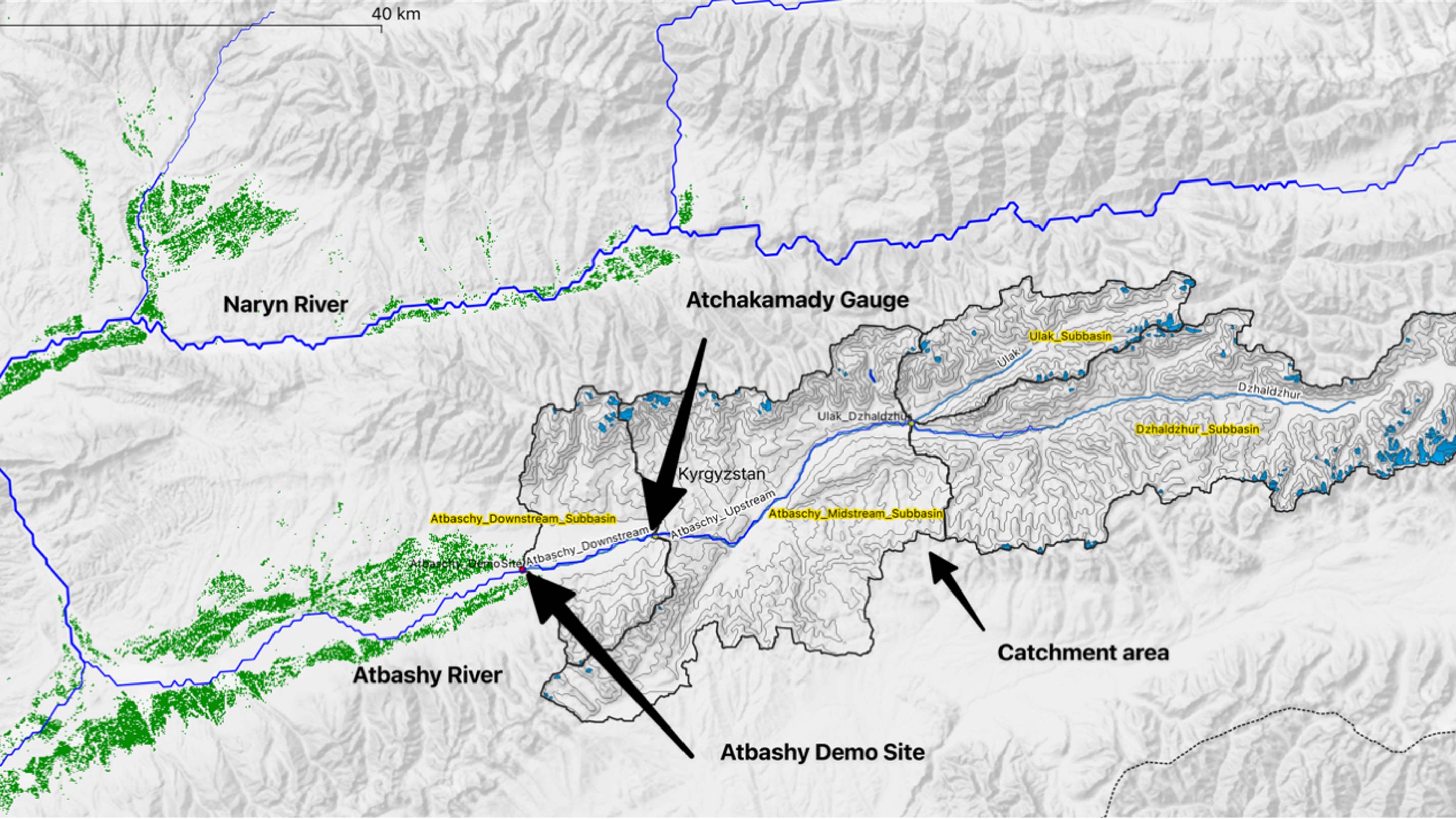
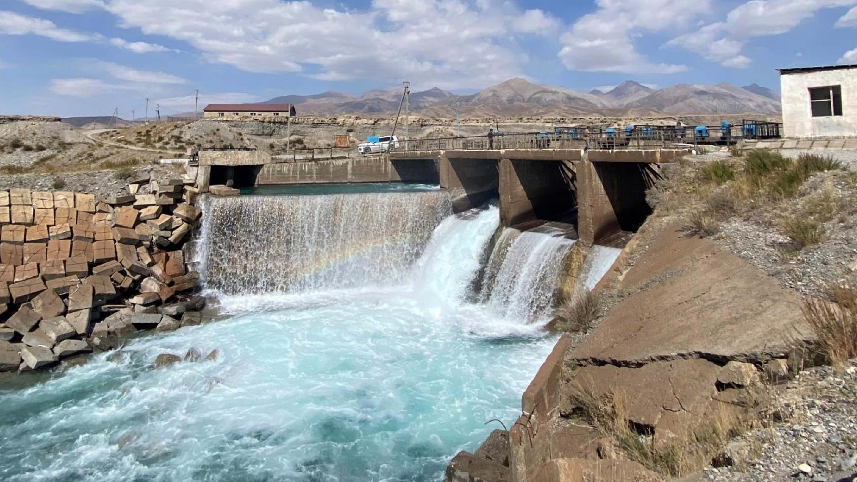
The Atbashy River is a left tributary to the Naryn located in the Naryn catchment in Kyrgyzstan (Figure 1). The river is suitable for small scale hydropower development and has been chosen as a case study under the EU-supported Hydro4U Project (www.hydro4u.eu). At a demonstration site in the basin, the project implements a shaft power plant which is a low-head, run-of-river power system with fish friendly intake. Figure 2 shows the site.
Mean discharge over the observation record was 16.6 m3/s, which corresponds to 350 mm mean specific discharge. The discharge regime is nivo-glacial and strongly seasonal with minimum flows during the cold winter months (October through March, mean discharge of 8.25 m3/s) and peak flows during the warm season from April through September (mean discharge of 24.8 m3/s). In winter, the river is normally covered with a significant ice cover (> 30 cm).
As part of the plant’s feasibility study, hydrosolutions GmbH conducted a detailed flood frequency analysis to study return levels for 2-year, 20-year, 50-year, and 100-year events under current and future climate. Insights of such detailed risk analysis of hydrological extremes can inform structure design, influence operation and management, and help quantify climate impacts on infrastructure and operations.
To robustly estimate return levels, we need long time series. In reality, we do not have such a long observation record. Hence,we use a deep neural net (DoppelGANger model, see https://arxiv.org/abs/1909.13403) with Google’s Tensorflow library and Colab pro (https://colab.research.google.com/) for training a deep neural network on past daily observed and future CMIP6 climate data. With the trained network, we can generate synthetic 1’000-year climate time series and run the hydrological model with this forcing. The resulting daily 1’000-year discharge data can then be used for robust flood frequency analysis (Figure3).
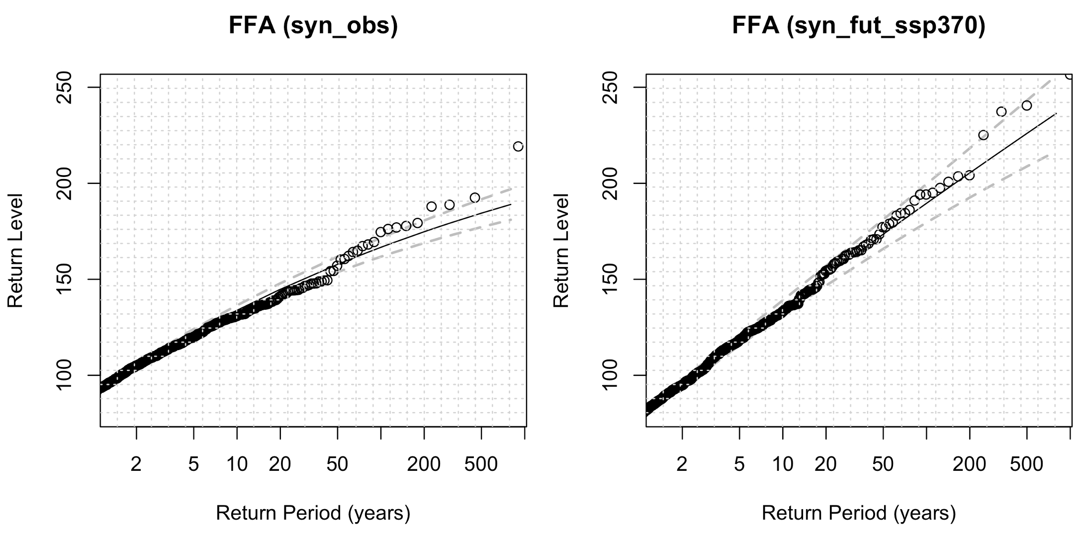
Our results suggest that under the high emission scenario SSP3-7.0, we will see more extreme hydrological extremes in the future in Central Asia. In other words, for a given return period, we expect higher return levels, except for return periods 5 years and flows smaller than 120 m3/s. Similarly, for a given return levels, we expect shorter return periods, except for smaller return levels and ranges as mentioned before. Whereas the current 50-year mean return level is 158 m3/s, it is expected in increase to 174 m3/s under the SSP3-7.0 scenario, as an example (Figure 3).
In conclusion, the zone of runoff formation in high mountain Central Asia will experience more severe hydrological extremes more frequently in the future. This requires targeted mitigation and adaptation measures for the management of the increasing risks to ensure the safety of livelihoods and infrastructure locally.